Indonesian Mountain

Indonesian Mountain
Indonesian beautiful

Monday 9 June 2008

Mount Puncak Jaya / Carstenz Pyramid (4884 on the sea level)

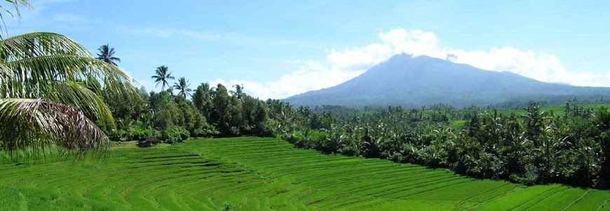
Carstenz pyramid (4884 OSL) peak is one of seven most famous peak in the world. Name Carstenz taking from the mount founding, Yan Carstenz from West Europe. In that time, 1623, Carstenz saw groups of snowed mount from southeast Papua Nugini direction. But, the truth could be verification in 1899 by Dutch expedition mapped the island contour. As a honour, the highest peak on Sudirman mountain range named carstenz peak. Beside the Carstenz, there are many others high peak like Sumantri Peak, Soekarno Peak (4826 OSL), Middle Carstenz Peak, and East Carstenz Peak. The first Indonesian expedition in order to reach Cartentz Peak members Fred Athaboe, Sudarto, Sangirin and three Japan peoples, they reach the peak on 1964.

The mount usually climbs by professional climbers, needs any complete equipment and the local potter. The route is: Tembagapura or Illaga – Lembah Danau – Danau – Cartetz Peak.


The great


a giant


gigant

Alternate Name(s) :
Carstensz
Latitude/Longitude (WGS84) :
4° 5' S; 137° 9' E
-4.076859, 137.156262 (Dec Deg)
739391E 9549057N Zone 53 (UTM)
Country :
Indonesia (Highest Point)
State/Province :
Irian Jaya (Highest Point)
Drainage Basins :
Mamberamo
Pacific Ocean
Island :
New Guinea (Highest Point)
Ownership :
Land : Gunung Lorentz

Prominence :
Clean Prominence: 4884 m/16,024 ft
Optimistic Prominence: 4884 m/16,024 ft
Key Col : Ocean 0 m/0 ft
Isolation :
Distance to Higher Peak: 5262.57 km/3270.71 mi
Nearest Higher Neighbor: Yulongxue Shan (NW)


let's see Bali paradise


Mount Binaiya (3055 on the sea level)

Binaiya Peak is a highest spot on the Seram island, located on Taman Nasional Manusela. On 1972 this national conservation park regarded into two partition. The first is Wae Mual with 17500 Ha space area. The second is Wae Nua takes 20000 Ha space area. The best time to climbs this mount is on dry climate, May - October month.
The route is [Ambon – Wahai – Kanikeh] – Kamp 27 – Waisomasa – Desa Kanikeh – Wiansela – Waihuhu –Waipuku – Binaiya Peak

a part of Manusela Park


Let's see Bali Paradise

Mount Rante Mario (3478 on the sea level)

Lantimojong mountain range stretch across South Sulawesi until Middle Sulawesi, include 11 mounts peaks, average reach higher than 1000 meters from the sea level. These mounts are Segean Mount ( 1373 meters OSL), Mount Sinagi, Mount Rantenemori, Mount Rante Kombola (3455 meters OSL), Mount Pentealoan, Mount Pakah Panjang, and the highest at the groups is Rante Mario Peak (3478 OSL).
In this mountain range especially at Latimojong, we can find any protected fauna like Babi Rusa, small Bulls, and Anoa. Base on geographical mapping, this mount located on Tanah Toraja district and north direction Enrekang residence.
The best time to climbs the mount is on dry climate, April until November month. The tracking route is [Pare-Pare – Enrekang – Buntudeo] – Rantelemo – Pos I (Base Camp I) – Pos II (Base Camp II) - Pos III (Base Camp III) - Pos IV (Base Camp IV) - Pos V (Base Camp V) - Pos VI (Base Camp VI) - Pos VII (Base Camp VII) – Rante Mario Peak.


anoa


Babi Rusa


let's see Bali Paradise

Mount Tambora (2851 on the sea level)

This volcano stand up 2851 on the sea level highs, located in north cape at Bima residence, Sumbawa island that known as horses milk and honey producer. The mountain range stretch across in groups of lime mounts, average 778-2851 meters highs on the sea level. Tambora is the highest mountain.
Base on historical story, in 1851 happened a big eruption that killed 92.000 mans. The effect of the eruption influence USA climate.

There is a route to access mount peak: [Dompu – Calabai – Pancasila Village] – Pos I (Base Camp I) – Pos II (Base Camp II) – Pos III (Base Camp III) – Pos IV (Base Camp IV) – Pos V (Base Camp V) – Tambora Peak

hmm.... yummy


Country:Indonesia
Subregion Name:Lesser Sunda Islands (Indonesia)
Volcano Number:0604-04=
Volcano Type:Stratovolcano
Volcano Status:Historical
Last Known Eruption: 1967 ± 20 years
Summit Elevation:2850 m 9,350 feet
Latitude: 8.25°S 8°15'0"S
Longitude:118.00°E118°0'0"E


Let's see Bali Paradise

Mount Rinjani (3726 meters on the sea level)

Rinjani names taking from Javanese language means “The great”. Base on Sasak race story, Mount Rinjani is Anjani Goddes castle. Anjani Goddes believes live at bank of Segara Anakan lake, as a horse rider human body looking out.
Mount Rinjani located in West Lombok residence, east Lombok residence and Middle Lombok residence. Base on government rules, the mountain entered as conservation area, named Taman Nasional Gunung Rinjani (Mount Rinjani National Conservation Park).
This mountain also familiar as most visited mountain in Indonesia, exactly there are 46.000 visitors a years. Usually visitor takes these route:
Track I (east track): [Mataram – Aikmel – Semalun Lawang] – Pos Pemantauan (Ground Base camp) – Pos Tengingian (Tengingian Base Camp) – Pos Padabalong (Padabalong Base Camp) – Plawangan Sembalun – Rinjadi Peak

Track II(south track) : [Mataram – Anyar – Senaru] – Pos I (Base Camp I) – Pos II (Base Camp II) – Pos III (Base Camp III) - Plawangan Senaru – Segara Anak Lake – Plawangan Sembalun – Rinjani Peak.
Track III (northeast track) : [Mataram - Bayan – Torean] – Pos I (Base Camp I) – Kokok Putih – Segara Anak Lake – Plawangan – Sembalun- Rinjani Peak.

Rinjani...


Beauty....


a piece of Indonesian Beauty


Country:Indonesia
Subregion Name:Lesser Sunda Islands (Indonesia)
Volcano Number:0604-03=
Volcano Type: Stratovolcano
Volcano Status:Historical
Last Known Eruption: 2004
Summit Elevation: 3726 m 12,224 feet
Latitude: 8.42°S 8°25'0"S
Longitude: 116.47°E 116°28'0"E


Please Also Visit : Indonesia Vacation Tourism

Mount Agung (3142 meters on the sea level)

Mount Agung have a famous legend believes by the local people. In the story, one upon a times there is a monkey from heaven that playing with the moon. And then, three partial of the moon come down onto the earth. One part come down in Java island being Mount Merapi, one part on Lombok being Rinjani dan the other one come down to Bali being Mount Agung. Base on the story, Mount Agung believes as sacred place by local people.
Base on administration written, this highest mount on Bali Island located in Rendang district. In 1963 the mount erupted blowing lava and hot smoke killed 1.500 mans and destroying 90 families houses.

Mount Agung peak can to reach passing three route, southeast route from Budakeling passing Nangka, south track passing Sangkan Kuasa and southwest route, the most popular and save track : [Denpasar – Batubulan – Besakih] – Hutan Pengubengan – Agung Peak

The Great Mountain


fantastic....


oh my god... it's beauty


Country:Indonesia
Subregion Name:Lesser Sunda Islands (Indonesia)
Volcano Number:0604-02=
Volcano Type:Stratovolcano
Volcano Status:Historical
Last Known Eruption: 1964
Summit Elevation:3142 m10,308 feet
Latitude: 8.342°S 8°20'30"S
Longitude:115.508°E115°30'30"E


Please Also Visit : Indonesia Vacation Tourism

Mount Raung (3332 on the sea level)

Mount Raung is a strato type volcano. Base on geographic map, the mountain located in Banyuwangi, Jember, and Bondowoso residence. From 1586 until this time, the mount has been erupt for 58 times, it’s biggest erupt blowing 60 kilometers distance lava spray.
On the record, the biggest eruption happened in 1638, 1.000 mans killed at the time.

To climbs this mountain, you must takes this route: [Jember –Wonosari – Sumber Wringin] - Pondok Motor – Pondok Sumur – Pondok Dhemit – Pondok Mayit – Pondok Mantri – Raung Peak.


Beauty Raung


Raung Crater


White clouds blanked


Country:Indonesia
Subregion Name:Java (Indonesia)
Volcano Number:0603-34=
Volcano Type: Stratovolcano
Volcano Status:Historical
Last Known Eruption: 2007
Summit Elevation: 3332 m 10,932 feet
Latitude: 8.125°S 8°7'30"S
Longitude: 114.042°E 114°2'30"E