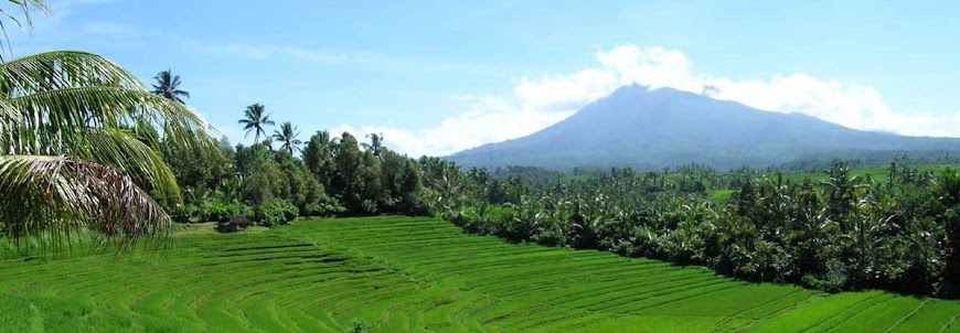
Indonesian Mountain

Indonesian Mountain
Indonesian beautiful

Monday, 9 June 2008

Mount Puncak Jaya / Carstenz Pyramid (4884 on the sea level)

Carstenz pyramid (4884 OSL) peak is one of seven most famous peak in the world. Name Carstenz taking from the mount founding, Yan Carstenz from West Europe. In that time, 1623, Carstenz saw groups of snowed mount from southeast Papua Nugini direction. But, the truth could be verification in 1899 by Dutch expedition mapped the island contour. As a honour, the highest peak on Sudirman mountain range named carstenz peak. Beside the Carstenz, there are many others high peak like Sumantri Peak, Soekarno Peak (4826 OSL), Middle Carstenz Peak, and East Carstenz Peak. The first Indonesian expedition in order to reach Cartentz Peak members Fred Athaboe, Sudarto, Sangirin and three Japan peoples, they reach the peak on 1964.

The mount usually climbs by professional climbers, needs any complete equipment and the local potter. The route is: Tembagapura or Illaga – Lembah Danau – Danau – Cartetz Peak.


The great


a giant


gigant

Alternate Name(s) :
Carstensz
Latitude/Longitude (WGS84) :
4° 5' S; 137° 9' E
-4.076859, 137.156262 (Dec Deg)
739391E 9549057N Zone 53 (UTM)
Country :
Indonesia (Highest Point)
State/Province :
Irian Jaya (Highest Point)
Drainage Basins :
Mamberamo
Pacific Ocean
Island :
New Guinea (Highest Point)
Ownership :
Land : Gunung Lorentz

Prominence :
Clean Prominence: 4884 m/16,024 ft
Optimistic Prominence: 4884 m/16,024 ft
Key Col : Ocean 0 m/0 ft
Isolation :
Distance to Higher Peak: 5262.57 km/3270.71 mi
Nearest Higher Neighbor: Yulongxue Shan (NW)


let's see Bali paradise


Mount Binaiya (3055 on the sea level)

Binaiya Peak is a highest spot on the Seram island, located on Taman Nasional Manusela. On 1972 this national conservation park regarded into two partition. The first is Wae Mual with 17500 Ha space area. The second is Wae Nua takes 20000 Ha space area. The best time to climbs this mount is on dry climate, May - October month.
The route is [Ambon – Wahai – Kanikeh] – Kamp 27 – Waisomasa – Desa Kanikeh – Wiansela – Waihuhu –Waipuku – Binaiya Peak

a part of Manusela Park


Let's see Bali Paradise

Mount Rante Mario (3478 on the sea level)

Lantimojong mountain range stretch across South Sulawesi until Middle Sulawesi, include 11 mounts peaks, average reach higher than 1000 meters from the sea level. These mounts are Segean Mount ( 1373 meters OSL), Mount Sinagi, Mount Rantenemori, Mount Rante Kombola (3455 meters OSL), Mount Pentealoan, Mount Pakah Panjang, and the highest at the groups is Rante Mario Peak (3478 OSL).
In this mountain range especially at Latimojong, we can find any protected fauna like Babi Rusa, small Bulls, and Anoa. Base on geographical mapping, this mount located on Tanah Toraja district and north direction Enrekang residence.
The best time to climbs the mount is on dry climate, April until November month. The tracking route is [Pare-Pare – Enrekang – Buntudeo] – Rantelemo – Pos I (Base Camp I) – Pos II (Base Camp II) - Pos III (Base Camp III) - Pos IV (Base Camp IV) - Pos V (Base Camp V) - Pos VI (Base Camp VI) - Pos VII (Base Camp VII) – Rante Mario Peak.


anoa


Babi Rusa


let's see Bali Paradise

Mount Tambora (2851 on the sea level)

This volcano stand up 2851 on the sea level highs, located in north cape at Bima residence, Sumbawa island that known as horses milk and honey producer. The mountain range stretch across in groups of lime mounts, average 778-2851 meters highs on the sea level. Tambora is the highest mountain.
Base on historical story, in 1851 happened a big eruption that killed 92.000 mans. The effect of the eruption influence USA climate.

There is a route to access mount peak: [Dompu – Calabai – Pancasila Village] – Pos I (Base Camp I) – Pos II (Base Camp II) – Pos III (Base Camp III) – Pos IV (Base Camp IV) – Pos V (Base Camp V) – Tambora Peak

hmm.... yummy


Country:Indonesia
Subregion Name:Lesser Sunda Islands (Indonesia)
Volcano Number:0604-04=
Volcano Type:Stratovolcano
Volcano Status:Historical
Last Known Eruption: 1967 ± 20 years
Summit Elevation:2850 m 9,350 feet
Latitude: 8.25°S 8°15'0"S
Longitude:118.00°E118°0'0"E


Let's see Bali Paradise

Mount Rinjani (3726 meters on the sea level)

Rinjani names taking from Javanese language means “The great”. Base on Sasak race story, Mount Rinjani is Anjani Goddes castle. Anjani Goddes believes live at bank of Segara Anakan lake, as a horse rider human body looking out.
Mount Rinjani located in West Lombok residence, east Lombok residence and Middle Lombok residence. Base on government rules, the mountain entered as conservation area, named Taman Nasional Gunung Rinjani (Mount Rinjani National Conservation Park).
This mountain also familiar as most visited mountain in Indonesia, exactly there are 46.000 visitors a years. Usually visitor takes these route:
Track I (east track): [Mataram – Aikmel – Semalun Lawang] – Pos Pemantauan (Ground Base camp) – Pos Tengingian (Tengingian Base Camp) – Pos Padabalong (Padabalong Base Camp) – Plawangan Sembalun – Rinjadi Peak

Track II(south track) : [Mataram – Anyar – Senaru] – Pos I (Base Camp I) – Pos II (Base Camp II) – Pos III (Base Camp III) - Plawangan Senaru – Segara Anak Lake – Plawangan Sembalun – Rinjani Peak.
Track III (northeast track) : [Mataram - Bayan – Torean] – Pos I (Base Camp I) – Kokok Putih – Segara Anak Lake – Plawangan – Sembalun- Rinjani Peak.

Rinjani...


Beauty....


a piece of Indonesian Beauty


Country:Indonesia
Subregion Name:Lesser Sunda Islands (Indonesia)
Volcano Number:0604-03=
Volcano Type: Stratovolcano
Volcano Status:Historical
Last Known Eruption: 2004
Summit Elevation: 3726 m 12,224 feet
Latitude: 8.42°S 8°25'0"S
Longitude: 116.47°E 116°28'0"E


Please Also Visit : Indonesia Vacation Tourism

Mount Agung (3142 meters on the sea level)

Mount Agung have a famous legend believes by the local people. In the story, one upon a times there is a monkey from heaven that playing with the moon. And then, three partial of the moon come down onto the earth. One part come down in Java island being Mount Merapi, one part on Lombok being Rinjani dan the other one come down to Bali being Mount Agung. Base on the story, Mount Agung believes as sacred place by local people.
Base on administration written, this highest mount on Bali Island located in Rendang district. In 1963 the mount erupted blowing lava and hot smoke killed 1.500 mans and destroying 90 families houses.

Mount Agung peak can to reach passing three route, southeast route from Budakeling passing Nangka, south track passing Sangkan Kuasa and southwest route, the most popular and save track : [Denpasar – Batubulan – Besakih] – Hutan Pengubengan – Agung Peak

The Great Mountain


fantastic....


oh my god... it's beauty


Country:Indonesia
Subregion Name:Lesser Sunda Islands (Indonesia)
Volcano Number:0604-02=
Volcano Type:Stratovolcano
Volcano Status:Historical
Last Known Eruption: 1964
Summit Elevation:3142 m10,308 feet
Latitude: 8.342°S 8°20'30"S
Longitude:115.508°E115°30'30"E


Please Also Visit : Indonesia Vacation Tourism

Mount Raung (3332 on the sea level)

Mount Raung is a strato type volcano. Base on geographic map, the mountain located in Banyuwangi, Jember, and Bondowoso residence. From 1586 until this time, the mount has been erupt for 58 times, it’s biggest erupt blowing 60 kilometers distance lava spray.
On the record, the biggest eruption happened in 1638, 1.000 mans killed at the time.

To climbs this mountain, you must takes this route: [Jember –Wonosari – Sumber Wringin] - Pondok Motor – Pondok Sumur – Pondok Dhemit – Pondok Mayit – Pondok Mantri – Raung Peak.


Beauty Raung


Raung Crater


White clouds blanked


Country:Indonesia
Subregion Name:Java (Indonesia)
Volcano Number:0603-34=
Volcano Type: Stratovolcano
Volcano Status:Historical
Last Known Eruption: 2007
Summit Elevation: 3332 m 10,932 feet
Latitude: 8.125°S 8°7'30"S
Longitude: 114.042°E 114°2'30"E

Mount Argopuro (3088 on the sea level)

Argopuro mountain is one of Hyang Mountain groups, pinched by three residence, Probolinggo, Jember and Bondowoso.
Base on ethnology, “Puro” means pura (Hindu Temple) and “Agro” means Mount. Completely, Argopuro means the Pura on the top of mount. In this mount there is many rest of historical cultural, from prehistoric era until Japan colonial era. In order to reach the mounts peak, climbers must passing about 32 kilometers small track, it’s the longest track in Java mounts. So, the climbers must preparing equipment, mentality and physic power before climbs the mountain.

Track I: [Probolinggo - Pajarakan – Bremi] – Taman Hidup - Pesingan - Cisentor –Rawa Embik – Argopuro Peak

Track II : [Probolinggo – Besuki – Baderan] – HM 17 – HM 43 – HM 68 - Cikasur – Cisentor – Rawa Embik – Argopuro Peak

argopuro


Please Also Visit : Indonesia Vacation Tourism

Arjuna and Welirang Mountains

Base on national administration, Arjuna - Welirang mountains located on Malang, Pasuruan, and Mojokerto residence. These twin mountains stretching across southeast until northwest East Java.
There is many track can be chosen to reach the peak. This mountain familiar as a mount that have thousand track.

Track I : [Surabaya – Pandaan – Tretes] – Pet Bocor – Kokopan – Pondokan – Welirang Peak [Surabaya – Pandaan – Tretes] – Pet Bocor – Kokopan – Pondokan – Lembah Kidang - Arjuna Peak
Track II : [Surabaya –Lawang – Wonosari] - Pondok Seng Atas – Pos Lintjing (Lintjing Base Camp) – Lali Jiwo – Arjuna Peak – Welirang Peak.

Track III : [Malang – Batu – Junggo] – Persimpangan Kembar – Arjuna Peak – Welirang Peak

Thanks god.


you are my Ajruno


Country:Indonesia
Subregion Name:Java (Indonesia)
Volcano Number:0603-29=
Volcano Type: Stratovolcano
Volcano Status:Historical
Last Known Eruption: 1952
Summit Elevation: 3339 m 10,955 feet
Latitude: 7.725°S 7°43'30"S
Longitude: 112.58°E 112°35'0"E


Please Also Visit : Indonesia Vacation Tourism

Mount Lawu (3265 on the sea level)

This mountain located between Middle Java and East Java provinces borders. Base on national administration, the mount is a part of Karang Anyar residence, Ngawi residence and Magetan residence. Lawu mountain is one of non active volcano.
At the moslem new years (suro month), the mountain crowded by the believers who make a pray on the top of the mount. Their numbers reach thousands people. Many cultural ceremonial performed at mystical places where spreading in the mountain areas.
If you want be a member that take participation on the ceremonial, you must reach the top of the mount taking these way:

Track I: [Solo - Tawang Mangu – Cemoro Kandang] – Pos I (Base Camp I) Taman Sari Bawah – Pos II (Base Camp II) Taman Sari Atas – Pos III (Base Camp III) Penggik – Pos IV (Base Camp IV) Cokro Suryo – Pos V – Hargo Dumilah Peak

Track II : [Madiun - Magetan – Cemoro Sewu] – Pos II (Base Camp II) – Pos III (Base Camp III) – Pos IV (Base Camp IV) – Pos V (Base Camp V) – Hargo Dumilah Peak.


so sweet....


cool


Country:Indonesia
Subregion Name:Java (Indonesia)
Volcano Number:0603-26=
Volcano Type: Stratovolcano
Volcano Status:Historical
Last Known Eruption: 1885
Summit Elevation: 3265 m 10,712 feet
Latitude: 7.625°S 7°37'30"S
Longitude: 111.192°E 111°11'30"E


Please Also Visit : Indonesia Vacation Tourism

Mount Merbabu (3173 on the sea level)

The Merbabu name taking from Javanese language, “meru” and “babu”. “Meru” means mountain and “babu” means maid. Yes, it is called maid mountain cause it’s non active mountain. The last eruption happened on 1968, witch made any died crater, they are Condrodimuko, Kombang, Kendang and Sambernyowo craters.
There is three route inaction to reach the peak. Usually, climbers taking different route when they start climbing and come back home.

Track I (south track) : [Salatiga – Kopeng – Takelan] – Pos Pending (Pending Base Camp) – Pos I (Base Camp I) Gumuk – Pos II (Base Camp II) Lempong Sampan – Pos III (Base Camp III) Watu Gubuk - Pos IV (Base Camp IV) Watu Tulis – Pos V (Base Camp V) Helipad – Kenteng Songo Peak
Track II (west track) : [Magelang – Kaponan – Wekas] – Pos I (Base Camp I) – Pos II (Base Camp II) – Pos Helipad (Helipad Base Camp) – Kenteng Songo Peak

Track III (south track) : [Surakarta - Cepogo – Selo] – Tarubatang – Pos I (Base Camp I) Balong – Pos II (Base Camp II) Pentur – Pos III (Base Camp III) – Kenteng Songo Peak


Merbabu Peak


Silence Mountain


Cute...


Country:Indonesia
Subregion Name:Java (Indonesia)
Volcano Number:0603-24=
Volcano Type: Stratovolcano
Volcano Status:Historical
Last Known Eruption: 1797
Summit Elevation: 3145 m 10,318 feet
Latitude: 7.45°S 7°27'0"S
Longitude: 110.43°E 110°26'0"E


Please Also Visit : Indonesia Vacation Tourism

Mount Merapi (2968 on the sea level)

11 July 1998, at 05.00 WIB (Indonesian time) Merapi erupted for any times. Black smoke, known as Wedhus Gembel spreading until 50 Km to west direction. The clouds, Wedhus Gembel, has very high temperature, it’s reach 3000­ Celcius degrees, can to destroy anything!
On 1994, about 66 people death and hundreds houses destroyed by Merapi Victim. On the past at 1930, this mountain erupted and 1.300 people killed by this angrily mount activity. The mountain also knows as the most active volcano on the earth.
Mount Merapi stand up about 30 KM north direction from Yogyakarta. In the foot area of the mountain, there is famous resort area named Kaliurang, the beautiful place to spend honeymoon times or recreation with family.
You can access the highest peak, named Garuda Peak, passing 3 route:

Track I (north track) : [Surakarta – Boyolali – Selo] – Lencoh – Watu Pecah – Pasar Bubrah - Merapi Peak.

Track II (South track) : [Jogja – Kaliurang – Kinahrejo] – Kendit – Merapi Peak.

Track III (West track) : [Yogyakarta – Muntilan – Babadan] – Klatakan – Merapi Peak.


elegant...


a giant


The Smiling Merapi


smoking....


awesome


Country:Indonesia
Subregion Name:Java (Indonesia)
Volcano Number:0603-25=
Volcano Type: Stratovolcano
Volcano Status:Historical
Last Known Eruption: 2008
Summit Elevation: 2968 m 9,737 feet
Latitude: 7.542°S 7°32'30"S
Longitude: 110.442°E 110°26'30"E


Please Also Visit : Indonesia Vacation Tourism

Mount Sundoro (3105 on the sea level)

The last eruption of this mountain happened on 1971 and then the Crater (lava hole) unactive until now. Across direction of the Sundoro mountain stand up Mount Sumbing, both of those mountains have same characteristic. About last 10 years, the mountain forest has been exploitation by human chainsaw, and then it’s exchanged into land farms.
From the peak you can sea Dieng Plateau, it’s very exotic panorama.

The peak can be accessed by these routes:
Track I (south track) : [Magelang – Temanggung – Kledung] – Pos I (Base Camp I) Si Bajing – Pos II (Base Camp II) Cawang – Pos III (Base Camp III) Seroto – Pintu Gerbang adelweiss – Sundoro Peak.

Track II (north peak) : [Wonosobo – Rejosari – Sigedang] – Perkebunan Teh Tambi (Tambi Tea Land Farm) – Sundoro Peak.


Sundoro and Land Farm


Strato Sundoro


Country:Indonesia
Subregion Name:Java (Indonesia)
Volcano Number:0603-21=
Volcano Type: Stratovolcano
Volcano Status:Historical
Last Known Eruption: 1971
Summit Elevation: 3136 m 10,289 feet
Latitude: 7.30°S 7°18'0"S
Longitude: 109.992°E 109°59'30"E


Please Also Visit : Indonesia Vacation Tourism

Mount Sumbing (3371 on the sea level)

Mount Sumbing gets second position as the highest mountain on Middle Java, the first place takes by Slamet mountain. This mountain base on administration rules, located in Wonosobo residence. This mountain very near to Sundoro mountain, only slicing by Temanggung - Wonosobo artileripass.
This mountain, naturally being a border for many residence, Banjanegara, Temanggung, Magelang, and Wonosobo. Sumbing and Sindoro usually visited by climbers from many town, like Yogyakarta and Semarang on holiday or weekend times. The culmination (peak) point of arrival numbers reached in Islamic new year. Many happening traditional art performed in this time.

There is two common tracks to reach the peak:
Track I (New route) : [Magelang – Temanggung – garung] – Pos II (Base Camp II) – Pasar Setan – Sumbing Peak.

Track II : [Magelang –Temanggung – Cepit] – Batu Lawang – Sumbing Peak

Beauty....


nicely.....

Country:Indonesia
Subregion Name:Java (Indonesia)
Volcano Number:0603-22=
Volcano Type: Stratovolcano
Volcano Status:Historical
Last Known Eruption: 1730 (?)
Summit Elevation: 3371 m 11,060 feet
Latitude: 7.384°S 7°23'3"S
Longitude: 110.070°E 110°4'13"E


Please Also Visit : Indonesia Vacation Tourism

Mount Slamet (3428 on the sea level)

This mountain stand up on 5 residences, Banyumas, Purbalingga, Pemalang, Tegal, and Brebes. This mountain get second position of highest mountain on Java Island, the Highest one is Mount Semeru at East Java province.
From 1948 until 1969, this mountain has been erupt for 12 times, and then it’s incident changes the peak conture.

There are three tracks can passed to reach the peak, those are:
Track I ( west track) : [Bumiayu – pangasinan - kaliwadas] – Pondok Growong – Taman Wlingi - Plawangan – slamet peak.

Track II (east track) : [Perwokerto – Purbalingga – Bambangan] - Pos Payung – Pondok Walang – Pondok Cemoro – Samaranthu – Plawangan – Slamet peak

Track III (south track) : [Purwokerto – batu raden] – Pos I (base camp I) – Pos II (base camp II) – Pos III (base camp III) – Pos IV (base camp IV) – Slamet peak

Behind Slamet

The Slamet Giant


Slamet Crater


Country:Indonesia
Subregion Name:Java (Indonesia)
Volcano Number:0603-18=
Volcano Type: Stratovolcano
Volcano Status:Historical
Last Known Eruption: 1999
Summit Elevation: 3428 m 11,247 feet
Latitude: 7.242°S 7°14'30"S
Longitude: 109.208°E 109°12'30"E


Please Also Visit : Indonesia Vacation Tourism

Mount Ciremai / Cereme (3078 on the sea level)

This mountain is the highest mountain in West Java. The mountain stand up on land of Majalengka residence, Cirebon and kuningan. The mountain last eruption happened on 1990. Many folks story says the mountain surrounded by mystical power. It is fulfill of myth.
The peak of Ciremai can be reached by passing 3 tracks, from Majalengka, Palutungan and Linggarjati. Linggarjati track is the hardest track, but many climbers love this way.

Those tracks are:
Track I (south track) : [Cirebon – Cigugur – Palutungan] – Cigowong – paguyangan badak – Blok Arban – Tanjakan Asoy – Pasanggrahan - Sang Hyang Ropoh - ciremai peak.

Track II (east track) : [Cirebon – Cilimus – Linggarjati] – cibeunar – Leuweng Datar – Kuburan kuda – Tanjakan bapa Tere – Batu Lingga - Pangasinan – ciremai peak

ciremei landscape


Blue and Green Ciremai


Lovely Cereme Crater

Country:Indonesia
Subregion Name:Java (Indonesia)
Volcano Number:0603-17=
Volcano Type: Stratovolcano
Volcano Status:Historical
Last Known Eruption: 1951
Summit Elevation: 3078 m 10,098 feet
Latitude: 6.892°S 6°53'30"S
Longitude: 108.40°E 108°24'0"E


Please Also Visit : Indonesia Vacation Tourism

Mount Gede (2958 on the sea level) and Mount Pangrango (3019 on the sea level)

Famously as Gede - Pangrango, This Strato twins mountain located in Cianjur Resident, Sukabumi and Bogor, West Java. On The 1811 Sir Thomas Raffles opened climber’s track from the southeast direction. And Than C.G.C Reinward had climb this mountain on 1819. This mountain attract many explorer like F.W. Junghunn (18-39-1861), J.E. Teysmain (1839), S. H. Koorders (1890), M. Treub (1891), W. M. Van Leeuden (1911), and C.G.J. Van Steenis (1920-1952). Indeed Gede – Pangrango mountain being natural object research spot from last century.
This mountain nearly to the Jakarta town, on 17 August many climbers climbs to the peak celebrating their national independence day.

There are three options of the track to reach the peak:
Track 1: [Jakarta – Cipanas – Cibodas] Telaga Biru – Pertigaan Cibeureum – Sungai Air Panas – Kandang Batu – Kandang Badak – Pangrango Peak or Gede Peak.
Track II : [Jakarta – Pasar Cipanas – Pos Gunung Putri] – Legok Leunca – Buntut Lutung – lawang Saketeng – Simpang maleber – Alun-alun Surya Kencana – Gede Peak

Track III : [Jakarta – Sukabumi – Selabintana] – Pos I (base camp I) – Pos II (base camp II) – Pos III (base camp III) – Pos IV (base camp IV) – Gede Peak.


Jakarta and it's Pangrango-Gede Backgound


Other side


Gede crater


Country:Indonesia
Subregion Name:Java (Indonesia)
Volcano Number:0603-06=
Volcano Type: Stratovolcano
Volcano Status:Historical
Last Known Eruption: 1957
Summit Elevation: 2958 m 9,705 feet
Latitude: 6.78°S 6°47'0"S
Longitude: 106.98°E 106°59'0"E


Please Also Visit : Indonesia Vacation Tourism

Mount Dempo (3173 on the sea level)

This Strato mountain stand up on Pagar Alam district, Lahat residence, Sumatra Selatan (South Sumatra) province. Surrounding by Barisan Hills range, and many other higher hills like Bukit Dingin, Bukit Payung and Gunung Marapi.
Many local peoples usually climb the mountain to plant tea trees or searching woods. Sometime, especially on holiday, people from brotherhood’s provinces climbs the mountain, to refresh their mind, body and soul.
In the foot of mountain area, we can see PTPN III, it’s national firm acts plantation business. From the village, PTPN III can reached about 1 hour driving car. And then, you must reach the peak with this track: [PALEMBANG - PAGAR ALAM - PTPN III] Kampung Empat – Pintu Rimbo – Pos I (Base Camp I) – Pos II (Base Camp II) – Makan Puyang Herlan (Puyang Herlan Cemetery) – Dempo Peak.
From the peak you can continuously to Lembah Parapuyang. From this spot, the sunrise and sunset very very beautiful. Just see it!

Dempo Blue Mountain


Mount Dempo Tea Plantation


Mount Dempo Crater


Country:Indonesia
Subregion Name:Sumatra (Indonesia)
Volcano Number:0601-23=
Volcano Type: Stratovolcano
Volcano Status:Historical
Last Known Eruption: 1994
Summit Elevation: 3173 m 10,410 feet
Latitude: 4.03°S 4°2'0"S
Longitude: 103.13°E 103°8'0"E


Please Also Visit : Indonesia Vacation Tourism

Mount Kerinci (3805 on the sea level)

Mount Kerinci is one of mountains that standing on streams of Bukit Barisan hills range. This active volcano located in Taman Nasional Kerinci Seblat (Kerinci Seblat National Conservation Park). Base on the national administration, this mountain places on both Sumatera Barat (West Sumatra) and Jambi Province.
The Taman Nasional Kerinci Seblat (Kerinci Seblat National Conservation Park) founded as natural flora and fauna conservation, like Harimau Sumatra (Sumatra Tigers), Wau-Wau, Siamang, Ungko etc.
If you wants to reach the peak you can takes this major track: [Bangko – Sungai penuh - Kersik Tuo (tugu macan)]R Sepuluh – Pintu Rimbo – Pesanggrahan I – Pesanggrahan II – Pesanggrahan III/ POS I (Base camp I) – POS II (Base camp II) – POS III (Base camp III) – The Peak of Mount Kerinci
From the peak, you can see exotic landscape, and the horizon of Hindia Ocean on the west direction.

Beauty Kerinci

exotic kerinci

beloved kerinci

kerinci crater


Country:Indonesia
Subregion Name:Sumatra (Indonesia)
Volcano Number:0601-17=
Volcano Type: Stratovolcano
Volcano Status:Historical
Last Known Eruption: 2008
Summit Elevation: 3800 m 12,467 feet
Latitude: 1.697°S 1°41'50"S
Longitude: 101.264°E 101°15'52"E


Please Also Visit : Indonesia Vacation Tourism

Mount Leuser (3381 on the sea level)

The name of Mount Leuser taking from Dutch language, means “Place to ending your live”. Leuser mountain located in Taman Nasional Gunung Leuser ( Mount Leuser National Conservation Park), Nangro Aceh Darussalam. TNGL is the place that protect natural ecosystem, nature flora and fauna habitats. The park familiar as world’s O­2 producer. Which large numbers of it’s tropical rain forest, they have micro climate as a climate stabilizer. There are 380 species of birds and 190 mammals. It’s mean 1/32 from world population or ¼ Indonesian mammals population.

This mountain is one of climbers dreams. The track have variations type and long way, needs skillful climbers to reach the mount’s peak. There are fours common tracks that usually taken by the climbers. One of them is Green Sinebuk – Simpang Angkasan – Jambur – Puncak Angkasan – Simpang Ji’it – Lintasan Badak – Blangbeke – Kolam Badak – Bipak – Bipak Kaleng – Bipak Batu – Padang Sabana – Loser Peak.


Mount Leuser


Mount Leuser National Park


Please Also Visit : Indonesia Vacation Tourism