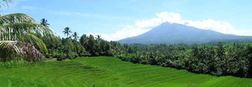
Indonesian Mountain

Indonesian Mountain
Indonesian beautiful

Monday, 9 June 2008

Mount Argopuro (3088 on the sea level)

Argopuro mountain is one of Hyang Mountain groups, pinched by three residence, Probolinggo, Jember and Bondowoso.
Base on ethnology, “Puro” means pura (Hindu Temple) and “Agro” means Mount. Completely, Argopuro means the Pura on the top of mount. In this mount there is many rest of historical cultural, from prehistoric era until Japan colonial era. In order to reach the mounts peak, climbers must passing about 32 kilometers small track, it’s the longest track in Java mounts. So, the climbers must preparing equipment, mentality and physic power before climbs the mountain.

Track I: [Probolinggo - Pajarakan – Bremi] – Taman Hidup - Pesingan - Cisentor –Rawa Embik – Argopuro Peak

Track II : [Probolinggo – Besuki – Baderan] – HM 17 – HM 43 – HM 68 - Cikasur – Cisentor – Rawa Embik – Argopuro Peak

argopuro


Please Also Visit : Indonesia Vacation Tourism

Arjuna and Welirang Mountains

Base on national administration, Arjuna - Welirang mountains located on Malang, Pasuruan, and Mojokerto residence. These twin mountains stretching across southeast until northwest East Java.
There is many track can be chosen to reach the peak. This mountain familiar as a mount that have thousand track.

Track I : [Surabaya – Pandaan – Tretes] – Pet Bocor – Kokopan – Pondokan – Welirang Peak [Surabaya – Pandaan – Tretes] – Pet Bocor – Kokopan – Pondokan – Lembah Kidang - Arjuna Peak
Track II : [Surabaya –Lawang – Wonosari] - Pondok Seng Atas – Pos Lintjing (Lintjing Base Camp) – Lali Jiwo – Arjuna Peak – Welirang Peak.

Track III : [Malang – Batu – Junggo] – Persimpangan Kembar – Arjuna Peak – Welirang Peak

Thanks god.


you are my Ajruno


Country:Indonesia
Subregion Name:Java (Indonesia)
Volcano Number:0603-29=
Volcano Type: Stratovolcano
Volcano Status:Historical
Last Known Eruption: 1952
Summit Elevation: 3339 m 10,955 feet
Latitude: 7.725°S 7°43'30"S
Longitude: 112.58°E 112°35'0"E


Please Also Visit : Indonesia Vacation Tourism

Mount Lawu (3265 on the sea level)

This mountain located between Middle Java and East Java provinces borders. Base on national administration, the mount is a part of Karang Anyar residence, Ngawi residence and Magetan residence. Lawu mountain is one of non active volcano.
At the moslem new years (suro month), the mountain crowded by the believers who make a pray on the top of the mount. Their numbers reach thousands people. Many cultural ceremonial performed at mystical places where spreading in the mountain areas.
If you want be a member that take participation on the ceremonial, you must reach the top of the mount taking these way:

Track I: [Solo - Tawang Mangu – Cemoro Kandang] – Pos I (Base Camp I) Taman Sari Bawah – Pos II (Base Camp II) Taman Sari Atas – Pos III (Base Camp III) Penggik – Pos IV (Base Camp IV) Cokro Suryo – Pos V – Hargo Dumilah Peak

Track II : [Madiun - Magetan – Cemoro Sewu] – Pos II (Base Camp II) – Pos III (Base Camp III) – Pos IV (Base Camp IV) – Pos V (Base Camp V) – Hargo Dumilah Peak.


so sweet....


cool


Country:Indonesia
Subregion Name:Java (Indonesia)
Volcano Number:0603-26=
Volcano Type: Stratovolcano
Volcano Status:Historical
Last Known Eruption: 1885
Summit Elevation: 3265 m 10,712 feet
Latitude: 7.625°S 7°37'30"S
Longitude: 111.192°E 111°11'30"E


Please Also Visit : Indonesia Vacation Tourism

Mount Merbabu (3173 on the sea level)

The Merbabu name taking from Javanese language, “meru” and “babu”. “Meru” means mountain and “babu” means maid. Yes, it is called maid mountain cause it’s non active mountain. The last eruption happened on 1968, witch made any died crater, they are Condrodimuko, Kombang, Kendang and Sambernyowo craters.
There is three route inaction to reach the peak. Usually, climbers taking different route when they start climbing and come back home.

Track I (south track) : [Salatiga – Kopeng – Takelan] – Pos Pending (Pending Base Camp) – Pos I (Base Camp I) Gumuk – Pos II (Base Camp II) Lempong Sampan – Pos III (Base Camp III) Watu Gubuk - Pos IV (Base Camp IV) Watu Tulis – Pos V (Base Camp V) Helipad – Kenteng Songo Peak
Track II (west track) : [Magelang – Kaponan – Wekas] – Pos I (Base Camp I) – Pos II (Base Camp II) – Pos Helipad (Helipad Base Camp) – Kenteng Songo Peak

Track III (south track) : [Surakarta - Cepogo – Selo] – Tarubatang – Pos I (Base Camp I) Balong – Pos II (Base Camp II) Pentur – Pos III (Base Camp III) – Kenteng Songo Peak


Merbabu Peak


Silence Mountain


Cute...


Country:Indonesia
Subregion Name:Java (Indonesia)
Volcano Number:0603-24=
Volcano Type: Stratovolcano
Volcano Status:Historical
Last Known Eruption: 1797
Summit Elevation: 3145 m 10,318 feet
Latitude: 7.45°S 7°27'0"S
Longitude: 110.43°E 110°26'0"E


Please Also Visit : Indonesia Vacation Tourism

Mount Merapi (2968 on the sea level)

11 July 1998, at 05.00 WIB (Indonesian time) Merapi erupted for any times. Black smoke, known as Wedhus Gembel spreading until 50 Km to west direction. The clouds, Wedhus Gembel, has very high temperature, it’s reach 3000­ Celcius degrees, can to destroy anything!
On 1994, about 66 people death and hundreds houses destroyed by Merapi Victim. On the past at 1930, this mountain erupted and 1.300 people killed by this angrily mount activity. The mountain also knows as the most active volcano on the earth.
Mount Merapi stand up about 30 KM north direction from Yogyakarta. In the foot area of the mountain, there is famous resort area named Kaliurang, the beautiful place to spend honeymoon times or recreation with family.
You can access the highest peak, named Garuda Peak, passing 3 route:

Track I (north track) : [Surakarta – Boyolali – Selo] – Lencoh – Watu Pecah – Pasar Bubrah - Merapi Peak.

Track II (South track) : [Jogja – Kaliurang – Kinahrejo] – Kendit – Merapi Peak.

Track III (West track) : [Yogyakarta – Muntilan – Babadan] – Klatakan – Merapi Peak.


elegant...


a giant


The Smiling Merapi


smoking....


awesome


Country:Indonesia
Subregion Name:Java (Indonesia)
Volcano Number:0603-25=
Volcano Type: Stratovolcano
Volcano Status:Historical
Last Known Eruption: 2008
Summit Elevation: 2968 m 9,737 feet
Latitude: 7.542°S 7°32'30"S
Longitude: 110.442°E 110°26'30"E


Please Also Visit : Indonesia Vacation Tourism

Mount Sundoro (3105 on the sea level)

The last eruption of this mountain happened on 1971 and then the Crater (lava hole) unactive until now. Across direction of the Sundoro mountain stand up Mount Sumbing, both of those mountains have same characteristic. About last 10 years, the mountain forest has been exploitation by human chainsaw, and then it’s exchanged into land farms.
From the peak you can sea Dieng Plateau, it’s very exotic panorama.

The peak can be accessed by these routes:
Track I (south track) : [Magelang – Temanggung – Kledung] – Pos I (Base Camp I) Si Bajing – Pos II (Base Camp II) Cawang – Pos III (Base Camp III) Seroto – Pintu Gerbang adelweiss – Sundoro Peak.

Track II (north peak) : [Wonosobo – Rejosari – Sigedang] – Perkebunan Teh Tambi (Tambi Tea Land Farm) – Sundoro Peak.


Sundoro and Land Farm


Strato Sundoro


Country:Indonesia
Subregion Name:Java (Indonesia)
Volcano Number:0603-21=
Volcano Type: Stratovolcano
Volcano Status:Historical
Last Known Eruption: 1971
Summit Elevation: 3136 m 10,289 feet
Latitude: 7.30°S 7°18'0"S
Longitude: 109.992°E 109°59'30"E


Please Also Visit : Indonesia Vacation Tourism

Mount Sumbing (3371 on the sea level)

Mount Sumbing gets second position as the highest mountain on Middle Java, the first place takes by Slamet mountain. This mountain base on administration rules, located in Wonosobo residence. This mountain very near to Sundoro mountain, only slicing by Temanggung - Wonosobo artileripass.
This mountain, naturally being a border for many residence, Banjanegara, Temanggung, Magelang, and Wonosobo. Sumbing and Sindoro usually visited by climbers from many town, like Yogyakarta and Semarang on holiday or weekend times. The culmination (peak) point of arrival numbers reached in Islamic new year. Many happening traditional art performed in this time.

There is two common tracks to reach the peak:
Track I (New route) : [Magelang – Temanggung – garung] – Pos II (Base Camp II) – Pasar Setan – Sumbing Peak.

Track II : [Magelang –Temanggung – Cepit] – Batu Lawang – Sumbing Peak

Beauty....


nicely.....

Country:Indonesia
Subregion Name:Java (Indonesia)
Volcano Number:0603-22=
Volcano Type: Stratovolcano
Volcano Status:Historical
Last Known Eruption: 1730 (?)
Summit Elevation: 3371 m 11,060 feet
Latitude: 7.384°S 7°23'3"S
Longitude: 110.070°E 110°4'13"E


Please Also Visit : Indonesia Vacation Tourism